Gallery
From the rig floor to the first bucket
Drilling, development, pump installation and handover. Our own site photographs from northern Uganda, alongside credited images of the same work across the region.
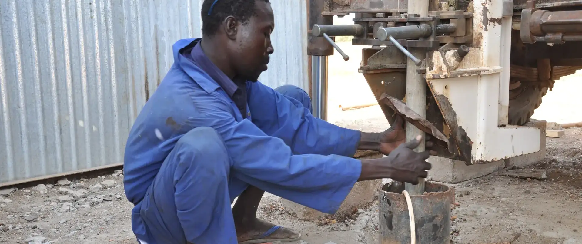
Photo: Oxfam East Africa, drilling for clean water in Upper Nile, South Sudan. CC BY 2.0, via Wikimedia Commons.
Our sites
Sub Saharan Drilling at work
These are our own photographs, taken on live contracts. They are old scans from the company archive, which is why the resolution is modest; the work they show has not changed.
-
The rig set up and drilling. Cuttings blown clear of the hole build up around the mast, and the crew reads the formation from them as the bit advances. -
Air-rotary drilling throws a dust cloud when the bit is in dry formation. The moment that plume turns to spray is the water strike, and the depth is logged there and then. -
A full crew on the rig. Hard hats and a fixed position for each man are what keep a rig floor safe when rods are being handled. -
The control panel. Air pressure and penetration rate tell the driller what the bit is in long before the cuttings reach the surface. -
Development. The well is airlifted until it runs clean, so that what is later sampled is aquifer water and not drilling residue. -
The finished water point: pump commissioned, apron cast, drainage running clear of the well head. This is the only measure of the job that matters.
The work, across the region
Drilling and water supply in Uganda and South Sudan
Rig work in Upper Nile, a completed water point in Rwamwanja, pump installation, apron construction and repair. These are freely licensed photographs from elsewhere in the region, not Sub Saharan Drilling sites, shown because they document the same work in the same conditions. Each is credited to its photographer under its licence.
-
A drilling technician at the well head in Upper Nile, South Sudan, on an Oxfam water programme. This is the work our own crews do on cross-border contracts from the Kitgum and Gulu bases. Photo: Oxfam East Africa, CC BY 2.0, via Wikimedia Commons. Resized and converted to WebP. -
A completed hand pump borehole in Rwamwanja, Kamwenge District, where we drilled for Stop Hunger Now and Feed the Hungry in 2015. Each water point there is run by a committee drawn from the community it serves. Photo: Andy Wheatley / DFID, UK Department for International Development, CC BY 2.0, via Wikimedia Commons. Resized and converted to WebP. -
A borehole serving households in the Bidibidi refugee settlement. Settlement water points carry far heavier daily use than a village well, which is why they are designed and maintained differently. Photo: Moses Elly, CC BY-SA 4.0, via Wikimedia Commons. Resized and converted to WebP. -
A community borehole under repair. Most failed water points in the region are not dry, they are waiting on a part and someone trained to fit it. Photo: Pastor Jimmy OO, CC BY-SA 4.0, via Wikimedia Commons. Resized and converted to WebP. -
Hand pump installation. The cylinder has to sit below the lowest dry-season pumping water level, or the pump runs dry exactly when it is needed most. Photo: Gizvula27, CC BY-SA 4.0, via Wikimedia Commons. Resized and converted to WebP. -
A well-built apron and drainage channel at an institutional water point. The rust-coloured staining is iron in the groundwater: harmless at these levels, but it marks clothing and cooking pots, and communities will walk away from a source that does it. Photo: Amuzujoe, CC BY-SA 4.0, via Wikimedia Commons. Resized and converted to WebP. -
A hand pump in daily use. Handle resistance and discharge per stroke are the two things a caretaker should watch: both change before a pump fails. Photo: Mozerayayena, CC BY-SA 4.0, via Wikimedia Commons. Resized and converted to WebP. -
Tap stands fed from a pumped and stored supply in Rhino Camp. Where demand is concentrated, a submersible system with storage moves far more water per day than a hand pump. Photo: Ronaldladu john, CC BY-SA 4.0, via Wikimedia Commons. Resized and converted to WebP. -
Collecting water in Moroto, Karamoja. Walking distance to the nearest working water point is the number that decides whether a borehole changes anything. Photo: Likefully, CC BY-SA 4.0, via Wikimedia Commons. Resized and converted to WebP.
Want to see the reports behind the pictures?
Every well we hand over comes with a lithological log, test pumping data, water quality results, coordinates and a photographic record. References are available on request.